
The standard hill-country formula says to locate a ridge, head down to a bench on its leeward side, and find your buck there. That advice does nothing for hunters on flat farmland, which anyone hunting level dirt already suspects. Terrain drives bedding choices in the hills. On flat ground, cover drives those choices, with ground variations measured in inches beneath it. Our own 1-meter LIDAR can reveal those subtle height differences that ordinary maps miss. Let it guide you toward a bedding zone rather than a marker with made-up precision.
KEY FINDINGS
- A downwind bench requires height differences your ground lacks. Slopes make benches, points that catch thermals, and hollows that drain possible. Remove 200 feet of height difference, and an ordinary topo layer has nothing it can sketch. The empty display leads a hunter to the mistaken belief that the land holds nothing.
- Cover supplies security on level land, just as terrain does in hills. For level country, our working model starts with cover, considers access to wind next, and then looks for the tiniest raised patch that stays dry. Ordinary topographic maps reveal little about either cover or wind access.
- The features that determine where deer bed are too small for the map to show. Typical contour lines are spaced 5 or 10 feet apart. A little rise disappears from that map, but 1-meter lidar can pick it out. The 1-meter LIDAR we own is a separate tool. It shows the ditch, waterway, and dry rise that the coarse layer smooths over.
"I just can't find the beds in farmland country, like I can in hill country."
A different hunter puts the difficulty this way: "When you turn on the topography, nothing happens. We just live in a flat swamp." Sound familiar? Either complaint means you're applying guidance meant for another landscape. Here's the problem in plain terms: hills make terrain the basis for bedding, while level land makes cover the basis. Swap that starting point and all the rules shift.
STEP 1 · WHY THE LEEWARD BENCH FAILS
Useful guidance that assumes slopes your land lacks
The usual hill-country approach is to locate a ridge, follow its point, and descend to the first bench on the downwind side. Hunters often describe bucks bedding there with the wind behind them. This is standard practice in the hills, and it depends entirely on changes in elevation. A leeward bench needs a slope to support it. A point that catches thermals matters only when air flows downhill through a hollow as the last daylight fades. Without elevation changes, those features disappear. Switch on the contour layer and the map looks empty. Standard topo has nothing to show at that scale.
The hunter on flat ground makes an understandable assumption: the buck has a bed "somewhere in that swamp," so reading terrain is pointless. That gets half the story right. The large, dramatic terrain features are absent. But height differences of a foot or two still determine whether a bed is dry or wet. Terrain at that small scale still controls the outcome. The map you received simply lacks the detail to show it.
STEP 2 · WHERE BEDDING ACTUALLY SITS
Midwestern cover that produces bedding
Set benches aside. First examine maps for cover that supports bedding in level country, then check those places while walking. With a good escape route, a buck can find security among 40 acres of grass reaching chest height even when the land has no ridge. The cover provides that protection.
Vegetation and edges used for beds
- Edges of switchgrass and CRP. Native grasses left standing can support bedding. Hunters often search just inward from the boundary, where deer have a view into open country and can catch scent from woods.
- Grassy waterways and drainage channels. In a harvested bean field, brush growing in a two-foot ditch can supply the only cover over a long distance.
- Thick fence lines and aging hedges. Old hedgerows and fencerows overrun with dense growth can support bedding, particularly when they link two sources of food.
- Small rises in marshes and sloughs. A swamp called "flat" still has bumps. Long-standing sand ridges, mounds covered by vegetation, and the only patch that remains an inch above the water's surface all count. Deer locate these spots. You need a way to locate them too.
- Uncut corn and crop corners full of weeds. A solid screen of vegetation surrounded by food matters to deer.
STEP 3 · THE RELIEF YOU CAN'T SEE
A likely bedding area instead of an exact map mark
Anyone charging you for an exact bed marker on level ground is claiming false precision. With no ridge to anchor the location, the marker is a guess presented with confidence.
Think of deer bedding as an area of likely use rather than one marked map point. The actual area might be a grass edge, with greater likelihood near the ditch-side corner and along the side that offers wind access. Find that area and hunt its boundary instead of searching for a single bed. Small changes in ground height may help choose between spots within the zone. We use micro-relief to rank spots inside a block of cover, but we have not tested micro-relief against bed locations. Contours spaced every 5 or 10 feet cannot show a rise only a foot or two tall. That is the challenge on flat ground: the features that may determine where deer bed are too small for the maps you use to show.
STEP 4 · WHAT 1-METER LIDAR SHOWS
Poor resolution leaves a blank display until you switch tools
USGS supplies a nationwide elevation grid at 1/3 arc-second spacing, with about 10 meters separating its points. Many topographic layers use that grid. Its detail is insufficient to depict a foot or less of height change across level land. The empty picture makes you think the ground contains nothing. Our internally built hunting topography from 1-meter LIDAR provides a different tool. Close sampling of bare ground lets it display drainage ditches, grassy waterways, marsh sand rises, and gentle rises along field boundaries that vanish in satellite pictures of harvested beans. On land described as "featureless," the micro-terrain view suddenly reveals structure.
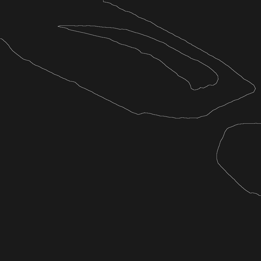
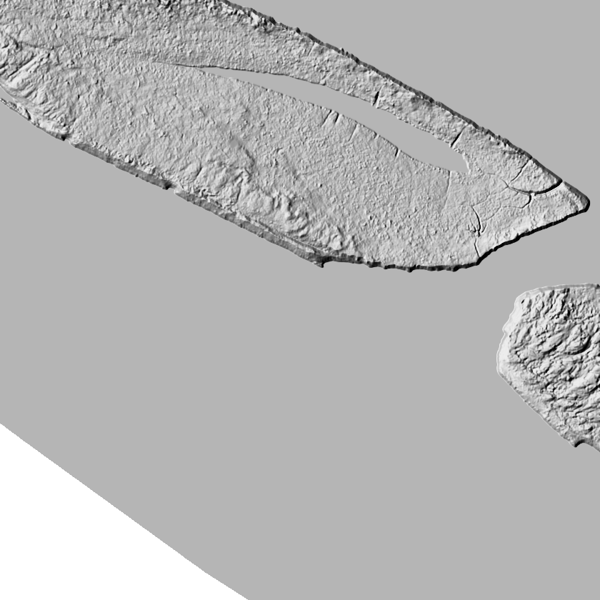
Imagine mapping an 80-acre level property with each method. Coarse contours at ordinary intervals leave an almost empty rectangle, with a faint contour touching a corner: the familiar "nothing here." Map that very property with 1-meter LIDAR hunting topography and a winding grassy waterway appears. A two-foot drainage channel follows its northern boundary. Within the CRP patch, three low rises a foot or two tall become visible. Those ditches, waterways, and raised dry places are already familiar to the buck. Greater detail reveals the little landforms the coarse view leaves out.
Standard topo · 10-ft contours, "nothing here"
1-meter lidar · shading exaggerated to show sub-meter relief
Look closer at a marsh section hunters call a "flat swamp." With leaves on the trees, the satellite image shows solid green and no structure you can read. Bare-earth shading from 1-meter LIDAR reveals old sand ridges and little humps within the same slough. The highest, driest hump becomes easy to spot. Compare those views and the complaint about a "flat swamp" explains itself. The features were always there; the earlier map lacked enough detail to show them. Reading flat ground takes the familiar terrain-reading skill to its highest level of detail. That explains why data resolution matters more here than anywhere else.
STEP 5 · STACK COVER OVER RELIEF
Bare dry ground is unlikely to support daytime bedding
Subtle terrain features point you toward higher, drier ground. To use them well, you also need a correct, up-to-date view of the cover. Flat-ground hunters can miss this problem until it costs them a hunt. A brushy fencerow used for bedding could have been cleared a year and a half earlier, yet the app's aerial photo still shows dense green growth. You could end up hunting a bedding spot that is gone. Aerial photos in general-purpose mapping apps may be several years old. Most are taken while trees have leaves, which can keep you from seeing recent cover changes. That gap matters on flat ground because the cover itself forms the bedding structure. County winter aerial photos taken after leaves fall let you see what cover was there when the camera captured it: which fencerows remained, which grass had been cut, and where dense growth stood that winter. Find out what year the photos were taken.
STEP 6 · THE PERFECT-MORNING TRAP
A calm, clear, cold sit is just when the forecast wind arrow gives you the wrong picture
Level ground brings another trap. A clear, calm morning seems perfect for easing into a setup beside bedding cover, yet that is when your wind is least dependable. No tool can predict how wind will swirl and pool at your stand. The aim is to warn when the wind arrow is unreliable. Our scent-flow layer provides only a risk screen: before you walk in, it combines the day's public forecast with a fixed thermal-terrain layer made from 1-meter LIDAR we own, marking the times and places where forecast wind is unreliable. Across six months of nighttime observations at one research site, measured wind differed by more than 90 degrees from that month's usual direction on about 45% of nights with calm, clear conditions. That happened on about 27% of windy nights, making it about 1.7 times as frequent in calm, clear conditions. Those measurements show that calm air wandered much more at that particular site. They did not evaluate a forecast. A forecast wind arrow warrants the least trust on clear, calm mornings. When thermals pool in every ditch on flat ground, hunt the zone's downwind boundary with the greatest scent margin that morning. Avoid betting on an unseen wind margin as narrow as 20-yard needlework.
STEP 7 · RUN IT ON YOUR OWN GROUND
Spot the ground features and cover deer have been using all along
For years, hunters on flat ground have heard the same advice: look for a bench on the downwind side. That bench doesn't exist here. But the ground does have ditches, grass edges, dry rises, and the cover layout that's there today. The maps you've been given hide those features. The right maps make them easy to see. These tools were made for this terrain: owned 1-meter LIDAR showing small changes in ground height, bedding-cover zones instead of invented pins, and county winter imagery captured after the leaves fall. The scent-risk screen marks mornings when you can't trust the forecast. As you get to know a buck, the field notebook helps you refine his pattern. You can keep that work private while hunting your lease, a farm where you have permission, or a public marsh you're figuring out. Open your "flat swamp" in Scout, switch on the 1-meter hunt-topo, and head out to find the rise among the grass.
Finding Buck Bedding in Flat Farmland
Bedding checks for level country
NOTES AND SOURCES
- Our bedding results identify cover-based zones of probable use rather than precise bed positions. Use each zone to guide decisions about hunting its edge, rather than treating it as a location marker with survey-grade accuracy.
- Hunting topography at 1-meter LIDAR resolution and county leaf-off photos support decisions using bare-ground and seasonal source data. They aren't survey products. Vegetation and ground conditions change between captures.
- Scent-flow results check risk without predicting wind direction. Public forecasts from the National Weather Service are paired with our fixed thermal-terrain layer to identify areas and hours carrying greater risk.
- The figures 27% and 45% reflect six months of nighttime observations at a single location. They compare recorded wind to the usual direction for the corresponding month, using that direction as a substitute for an actual forecast. The meaningful result is limited to the difference between windy nights and calm ones.
- Scout is live in all 50 states. Terrain and imagery detail and source dates vary by location.
- Neither deer activity nor hunting success is guaranteed by this information.
Fully Drawn Research is an independent data analysis desk, not affiliated with any state wildlife agency, transportation agency, mapping provider or outfitter. FDR shows cover-based bedding probability zones and scent-risk conditions, not exact bed locations or stand-level wind direction.
Keep reading
FDR Scout puts research like this on the map of the ground you hunt. Open Scout →