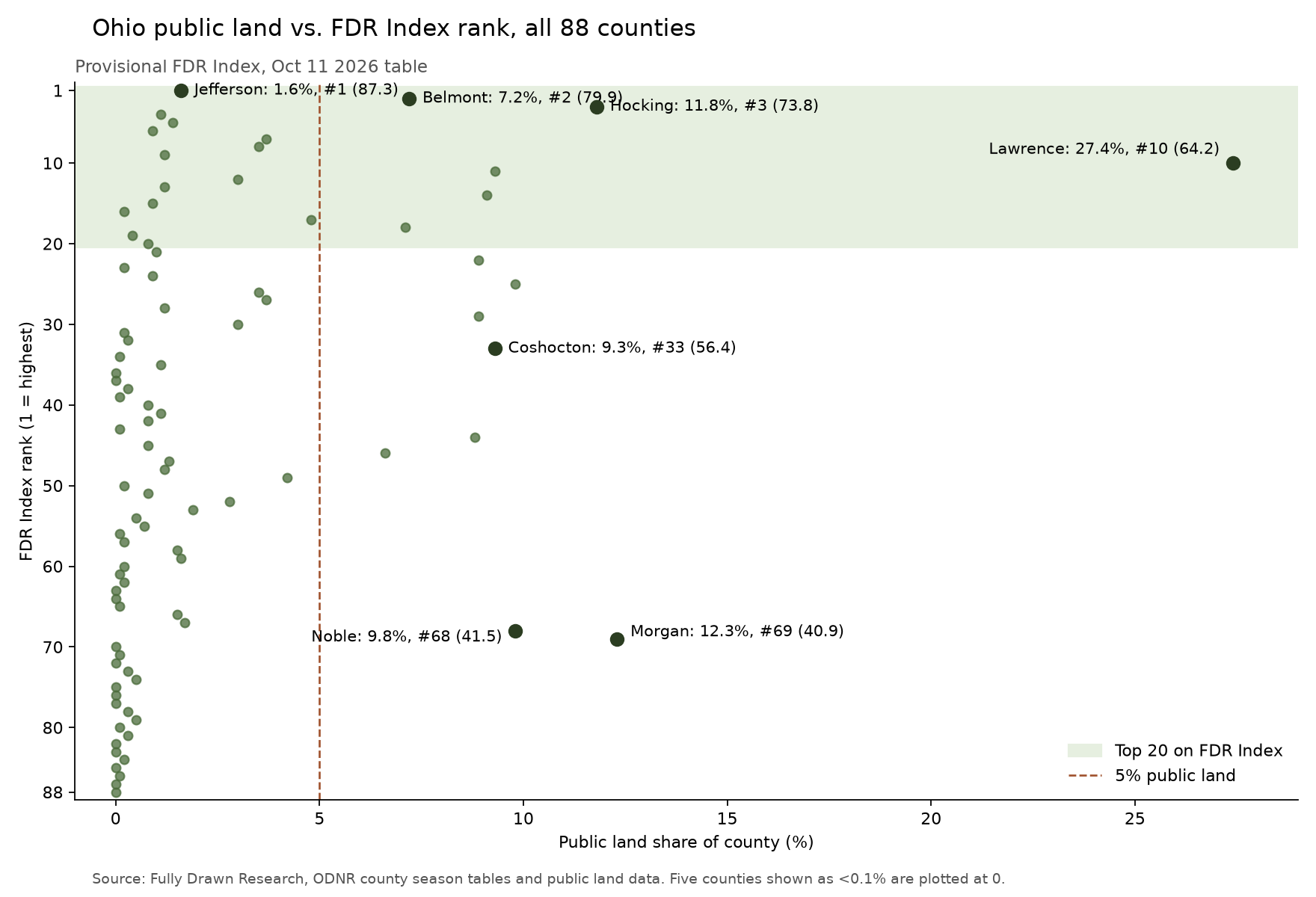
Lawrence County has the largest public land share of any county in Ohio. FDR's live Ohio rankings table puts its public land share at 27.4%. Lawrence also ranks tenth of 88 counties on the provisional FDR Index at 64.2.
Fourteen Ohio counties show 5% or more public land on the table, and six of them rank in the top twenty. Belmont is the strongest at second overall with 7.2% public land. Hocking ranks third with 11.8% and a Trophy Index of 97.
High public land, lower county rank
Morgan shows the other side. It has the second largest public land share at 12.3% and ranks 69th on the FDR Index. Noble sits next to it at 68th with 9.8%. Both still score 89 or higher on the Trophy Index.
The top ten leans private
The top of the table leans private. Seven of Ohio's top ten counties show less than 4% public land. Jefferson leads the state at 87.3 with 1.6%. The median Ohio county shows 0.8%.
Coshocton is the familiar name in the middle. It has 9.3% public land and 33,722 public land acres on its county page. It ranks 33rd at 56.4.
How to use the Ohio table
A public land hunter in Ohio can use the table two ways. Sort by score to see where the county model is strongest. Then read the public land column to see how much of that county is public ground. Every number here comes from FDR's Ohio rankings table and county pages, built from ODNR county season tables and public land data.