
Finding Buck Bedding in Flat Farmland
The hill-country doctrine (find the ridge, drop to the leeward bench, there's your buck) is useless on flat farmland, and every hunter who works flat dirt already suspects it. The reason is a single swapped input: in the hills deer bed to terrain; on flat ground they bed to cover, over micro-relief measured in inches. This guide explains why the standard map goes blank on flat ground, what an owned 1-meter LIDAR surface actually shows, and how to hunt a bedding zone instead of a fake pin.
"I just can't find the beds in farmland country, like I can in hill country."
Another, in the same breath: "When you turn on the topography, nothing happens. We just live in a flat swamp." If you've said either, you are not bad at reading terrain; you are running a playbook written for a different kind of ground. The whole problem fits in one sentence: in hill country deer bed to terrain; on flat ground deer bed to cover. Change the input and every rule changes with it.
- The leeward-bench rule needs vertical relief you don't have. A bench, a thermal-catching point, a draining hollow only exist because there is a slope for them to sit on. Take away 200 feet of elevation change and standard topo has nothing to draw, so the screen goes blank and the hunter wrongly concludes there is nothing there.
- On flat ground, cover creates the security terrain creates in the hills. Deer bed by three things in order: cover that hides them and breaks wind at bed height, wind and thermal access to smell trouble coming, and the tiniest high spot that keeps their belly dry and lifts their eyes above the grass. Two of the three are invisible on a standard map.
- The deciding features are smaller than the map's resolution. A whitetail will pick the spot in the CRP that sits 14 inches higher than the ground around it. Standard contours are drawn every 5 or 10 feet, so a 14-inch hump does not exist on that map, and absolutely exists to the buck. Owned 1-meter LIDAR is a different instrument; it renders the ditch, the waterway, and the dry hump the coarse layer flattens away.
IWHY THE LEEWARD BENCH FAILS
The classic move is real field-craft: find the ridge, walk the point, drop to the first bench on the downwind side, and there's your buck: nose into the wind, back to the thermal, eyes covering the rise below him. In the hills it flat-out works. But it is built entirely on vertical relief. A leeward bench only exists because a slope holds it up; a thermal-catching point only matters when air drains down a hollow at last light. Remove the elevation change and none of those features are there to find. That is why you flip on the contour layer and the screen goes blank. There is nothing at that scale for standard topo to draw.
So the flat-ground hunter does the reasonable thing: assumes the buck is bedding "somewhere in that swamp" and quits on terrain entirely. That's half right. Terrain in the big, dramatic sense is gone. But terrain in the small sense (the 12 to 18 inches of relief that decides whether a bed is wet or dry) is still running the show. You just can't see it with the map you were handed.
IIWHERE BEDDING ACTUALLY SITS
Forget benches. Walk your maps and your boots through the cover types that hold bedding on flat ground. The pattern under the pattern: a buck doesn't need a ridge to feel safe if he has 40 acres of chest-high grass and one good escape line. Cover is the security.
- CRP and switchgrass edges. Standing native grass is a bedroom, not a hallway. A mature buck beds a short distance inside the edge with the field at his back and timber at his nose; he sees the open ground, smells the timber, and vanishes. The thicker and taller the stand, the more he trusts it.
- Drainage ditches and grassed waterways. In a picked bean field that looks like a pool table, a two-foot brushy ditch is a mountain range to a deer: the only cover, the only relief, and the only thermal channel for a quarter mile.
- Overgrown fencerows and old hedgerows. The no-longer-maintained ones grown up thick will hold a buck all season if they connect two food sources and nobody bumps him.
- Marsh and slough micro-humps. "Flat swamp" is not flat. Old sand ridges, grown-over mounds, the one spot that stays an inch above the waterline; deer find them, and you need a way to find them too.
- Standing corn and weedy crop corners. Not glamorous. Deer care about a wall of cover with food on all sides, not glamour.
IIITHE 18 INCHES YOU CAN'T SEE
Anybody selling you an exact bedding pin on flat ground is faking precision. There's no ridge to anchor it to, so the pin is a guess with confidence.
Deer bedding is a zone of probability, not a pin on a map. What actually exists is a zone: this grass edge, weighted toward the corner with the ditch, favoring the side with wind access. Your job is not to find the bed. It is to find the zone and hunt its edge. Inside that zone, micro-relief is the tiebreaker: a whitetail picks the spot that is 14 inches higher than the ground around it, because that is where his belly stays dry after rain and his eyes clear the grass tips to see a coyote coming. Standard contours drawn every 5 or 10 feet cannot render a 14-inch hump. That is the whole game on flat ground: the features that decide bedding are smaller than the resolution of the maps you're using.
IVWHAT 1-METER LIDAR SHOWS
Standard elevation data (the stuff feeding the topo layer on the app you already pay for) is sampled too coarsely to render sub-foot relief on flat terrain. It shows nothing, and you conclude there is nothing there. FDR's own-built 1-meter LIDAR hunt-topo is a different instrument: it samples the bare-earth surface tightly enough to render the ditch, the grassed waterway, the sand hump in the marsh, and the subtle field-edge rise that a picked-bean satellite view flattens into nothing. On ground that reads "featureless," the micro-terrain layer suddenly has structure.
Picture the same 80-acre flat parcel drawn two ways. On the coarse standard-interval contour layer it is a nearly blank rectangle: one faint line clipping a corner, the classic "nothing here." On the 1-meter LIDAR hunt-topo of the identical parcel, a grassed waterway snakes through, a two-foot drainage ditch runs the north edge, and three subtle 12-to-18-inch humps light up inside the CRP block: the ditch, the waterway, and the dry high spots the buck already knows about. Same dirt, two resolutions; only one of them is telling the truth.
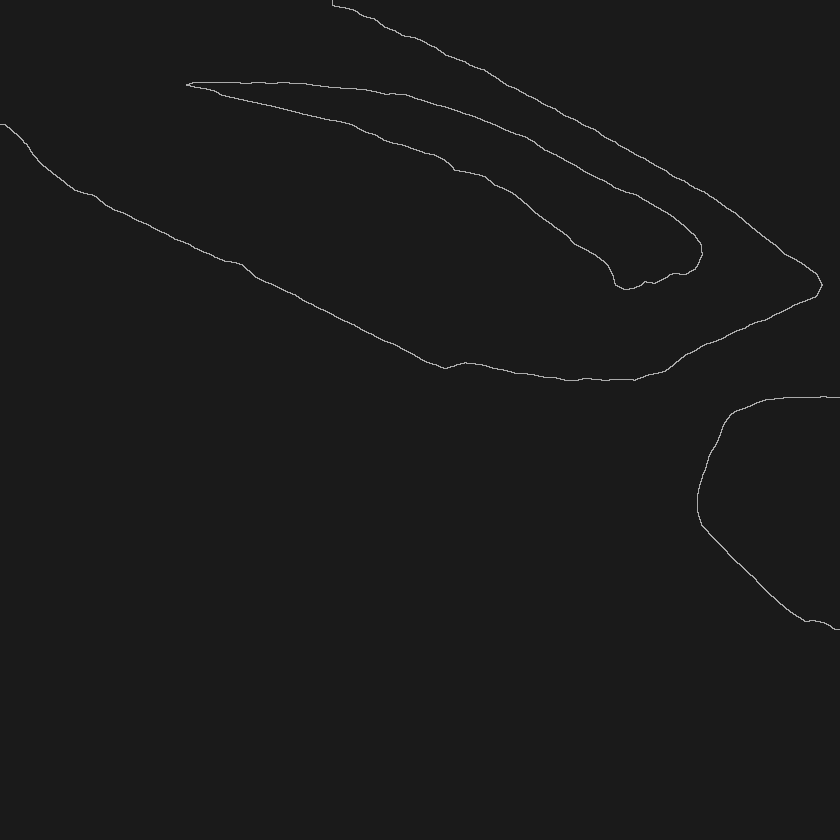
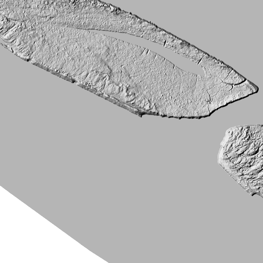
Now zoom into a "flat swamp" marsh section. A leaf-on satellite view is uniform green with no readable structure. The 1-meter LIDAR bare-earth shade of the same ground lifts old sand ridges and micro-humps out of the slough, with the highest, driest hump (the one where sign consistently shows up) standing out. Put the two views side by side and the "flat swamp" complaint answers itself: the ground was never featureless; the old map was just too blurry to draw it. Flat ground is the same terrain-reading skill turned up to maximum resolution, which is exactly why the resolution of your data matters more here than anywhere.
VSTACK COVER OVER RELIEF
Micro-terrain gets you the dry high spots, but you have to stack it under an accurate, current picture of the cover, and this is where flat-ground hunters get quietly burned. The overgrown fencerow that holds the bedding zone might have been bulldozed a year and a half ago while the leaf-on imagery in your app still shows it green and thick, so you hunt a bedroom that no longer exists. Aerial imagery in the big apps is often years old and leaf-on; on flat ground, where cover is the bedding structure, that is a fatal blind spot. County leaf-off winter imagery shows the actual current cover skeleton: which fencerows survived, which grass got mowed, where the real thick stuff is right now.
- Cover first. On leaf-off imagery, find the thickest, most-connected cover: switchgrass, overgrown fencerow, brushy ditch, standing marsh grass.
- Micro-relief second. On 1-meter LIDAR, find the highest, driest spot inside that cover. That is the anchor of the zone.
- Wind access third. Confirm the buck can bed there and smell his back trail, usually the downwind edge of the cover block relative to the prevailing wind.
- Draw the zone, not the pin. Shade the likely third of the cover block. Plan an entry that hunts its edge on the right wind, never through the middle.
- Log it. Every time you confirm or bust the zone, note it in a field notebook; flat-ground patterns tighten fast once you have a few data points on the same buck.
VITHE PERFECT-MORNING TRAP
One more flat-ground trap. The calm, clear, cold morning feels like the ideal day to slip into a bedding-edge setup, and it is exactly when your wind is least trustworthy. No tool can predict the swirling, pooling wind at your actual stand; that is physics, not a knock, and you know it in your gut. The honest move is not to sell you another confident arrow but to flag when the arrow can't be trusted. FDR's scent-flow layer does risk screening only: it lays the day's public forecast over a static thermal-terrain layer built from owned 1-meter LIDAR and flags when and where the forecast wind is unreliable, before the walk-in. Forecast wind-arrow unreliability climbs from about 27% to 45%, roughly 1.7×, precisely in those calm, clear, cold conditions. On flat ground with thermals pooling in every ditch, that is the morning to hunt the downwind edge of the zone with the most margin, not to thread a 20-yard needle you can't see.
VIIRUN IT ON YOUR OWN GROUND
The flat-ground crowd has been told for years to "find the leeward bench." You can't, because it isn't there. What is there (the ditches, the grass edges, the 14-inch dry humps, the current cover skeleton) is invisible on the maps you were handed and obvious on the right ones. The desk stack is built for exactly this ground: owned 1-meter LIDAR micro-relief, bedding-cover zones rather than fake pins, county leaf-off winter imagery, a scent-risk screen keyed to the mornings the forecast lies, and a field notebook to tighten the pattern as you learn a buck, all runnable privately on your own parcel, whether that's your lease, a permission farm, or the public marsh you're trying to crack. Pull up your "flat swamp" in Scout with Founders access, flip on the 1-meter hunt-topo, and go find the high spot in the grass.
- FDR bedding output shows cover-based probability zones, not exact bed locations; treat every zone as a decision aid to hunt the edge of, not a survey-grade pin.
- The 1-meter LIDAR hunt-topo and county leaf-off imagery are decision aids derived from bare-earth and seasonal sources, not survey products; ground conditions and cover change between captures.
- Scent-flow output is a risk screen, not a wind-direction prediction. It combines public National Weather Service forecast data with FDR's static thermal-terrain layer to flag higher-risk zones and hours.
- The 27%-to-45% figure is an FDR-measured result describing forecast wind-arrow unreliability under calm, clear, cold conditions relative to average conditions.
- Terrain and imagery layers are available in the states FDR currently covers (Illinois and Wisconsin live) with more of the Midwest rolling out through 2026.
- Nothing here guarantees deer activity or hunting success.
Fully Drawn Research is an independent data analysis desk, not affiliated with the Illinois Department of Natural Resources, the Illinois Department of Transportation, or any mapping or outfitting provider. FDR shows cover-based bedding probability zones and scent-risk conditions, not exact bed locations or stand-level wind direction.